

Sagres and Cape St. Vincent
The history of Sagres is also that of the coast of this part of
It is also attributed to the myth of St. Vincent, the 4th century martyr whose mortal remains were cast adrift in
 Beginning in 1415, Henry “the Navigator”, the son of King João I established his school on the Pont immediately to the east of Cape St. Vincent bringing together mariners, astronomers, cartographers, and ship designers to set the stage for establishing a maritime route around Africa to the riches of India and the Orient (see historical overview of Portugal).
These men would perfect the astrolabe and quadrant to allow for much more precise navigation. Up to that time mariners navigated by means of rough charts and dead reckoning. They could roughly determine the course they followed through the use of a magnetic compass. Their approximate average speed through the water was determined by streaming a weighted line astern and counting the numbers of knots, tied at precise equal distances apart, which passed through their hands in a specific number of minutes. Thus their speed in “knots” could be determined. While the methods of determining speed are more sophisticated today the speed is still stated in knots – or nautical miles per hour. A nautical mile is equal to 1 minute of latitude. Latitude is the distance north or south on the earth’s surface in a line running from the north to the south pole (or vice-versa. One half of the earth’s sphere being 180 degrees, there are 180 degrees between the north and south poles, or 90 degrees between the equator and either pole. Each degree has 60 minutes, thus there are 60 nautical miles in one degree of latitude. If a mariner could accurately measure how many degrees and minutes he was south or north of the equator he could place his ship more accurately on the earth’s surface. A better understanding of the place and movement of stars, the sun and moon and of earth’s visible planets and an accurate way of measuring their angle above the horizon would allow the mariner to calculate his latitude. Henry the Navigator’s astronomers devised methods to more accurately predict the movements of the moon, sun, stars and planets and tables to explain these movements to mariners. Coupled with the perfection of the astrolabe and quadrant to measure their angles above the horizon, mariners were able to much better measure their latitude, or their position north or south of the equator. This was a major step forward and it would fuel much of the impetus to eventually round Africa when their latitude was far enough south and then sail north again, eventually to
This more or less solved one half of the puzzle of being able to determine their position when on the open ocean, out of sight of known points of land. While it still did not allow them to determine how far west or east they were of Europe or
(The determination of east or west would still rely on dead reckoning until the British developed highly accurate chronometers that, in conjunction with astronomical observations, would permit them to calculate how far west (or east) they were of Greenwich, England - which the British defined as the zero or prime meridian of longitude and Greenwich Mean Time as the base of time measurement).
Henry’s “scholars” also perfected a vessel better suited to exploration, the caravel. With a relatively long waterline, shallow draft and a broad beam (width) they had a reasonable turn of speed but carried a good load of stores and crew. Bearing in mind the death rates on many of these voyages, before the discovery of the relationship of Vitamin C deficiency and scurvy, as well as the challenges of other diseases, large crews at the beginning of voyages were necessary if there was to be sufficient crew to return to 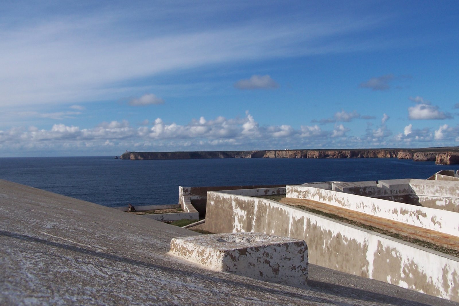 both square and triangular sails. Square sails permitted greater speed sailing before the wind while triangular sails permitted them to sail upwind by tacking back and forth. Contrary head winds (winds blowing from the direction in which they wished to proceed) were common in rounding the African cape, and being able to sail effectively into these winds was imperative to their success.
There is little physical evidence of Henry’s school at this sacred point. A windbreak wall now largely restored and capped by a false battlement,
a cistern tower, 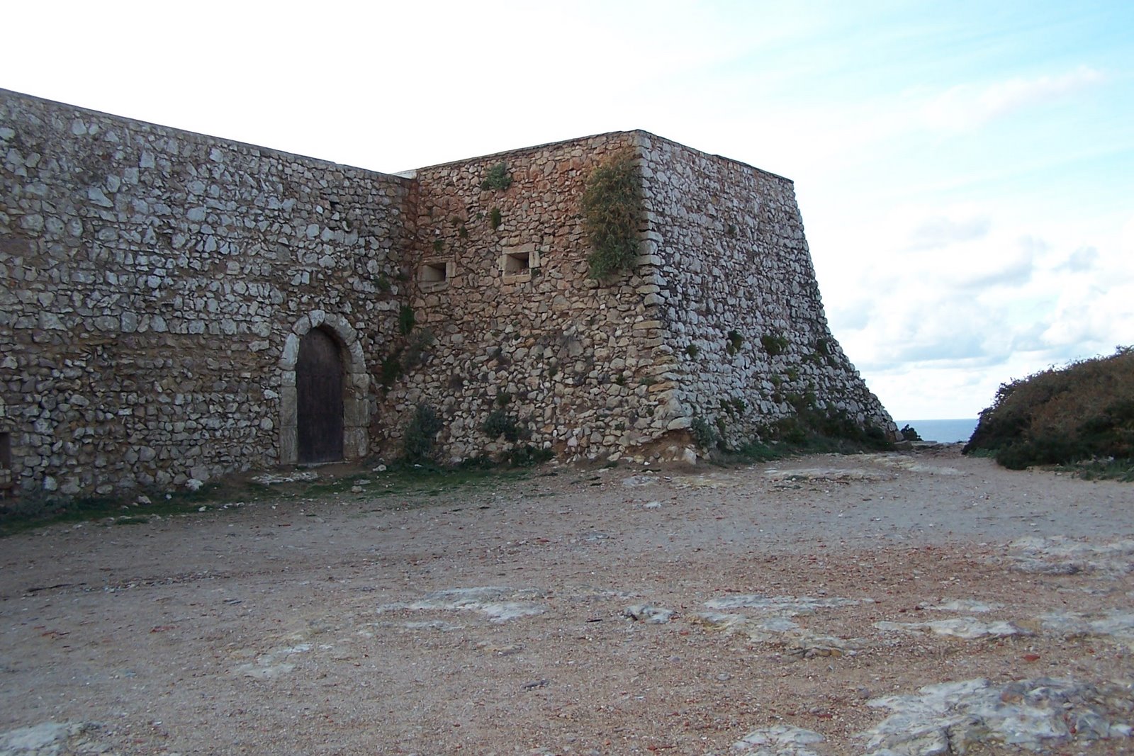
a monument (seen above) to Prince Henry the Navigator.

and the wind rose or mariner’s compass, discovered by accident in 1921.
 The site, known today as the Fortress of Sagres is
 nonetheless a place worth visiting to capture a bit of the sense of time and place where these critical marine developments occurred. The point also offers excellent views of
  framed by a 16th century chapel
or by a cannon of the same vintage (seen above)
.
But perhaps it is best seen alone in its dramatic grandeur.
If you like fishing on the edge and maybe falling off that old flat earth this could be an optimum choice. This might not look like a significant height from this perspective, but it is actually a big drop as the next pictures show.
Further along the undercutting of the point is quite evident. 
Marie-Claire and her sister
Jeanine are dwarfed by the sheer size of the cliffs they stroll along the top.

The nearby small town of

has a picturesque and functioning fisherman’s harbour,
while Cape St. Vincent, a few kilometres away, boasts significant winds, and nothing to the west until one reaches the
Somewhere we have the bookend to this: a picture of Roger with much more hair, and Marie-Claire, looking much the same (ever young), on the eastern-most point of North and Central 
posted by Retired and on the Move | 7:30 AM
![]()
<< Home