

Arizona
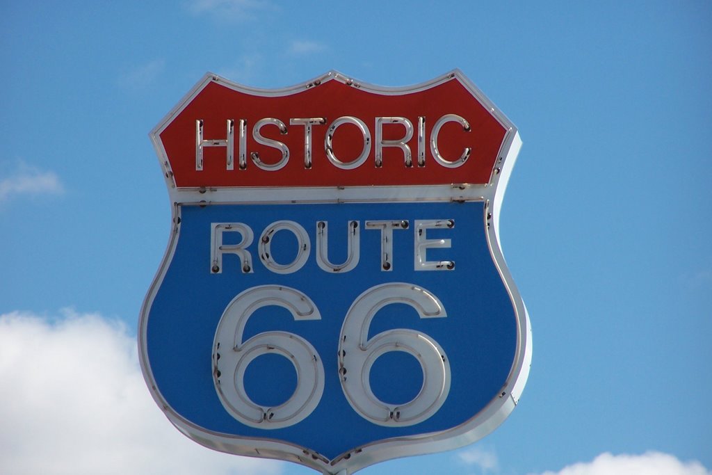
Flagstaff, Arizona is another place we haven’t seen in some years and it has grown considerably. Since leaving California we have been climbing steadily. En route we stop to explore the small town of Williams. Historic Route 66, made famous in song, has been replaced in large part by I-40, at least until 66 turns north toward Chicago. Williams is one of the towns where you can easily access Route 66 and taste the 1950’s. It is also the terminus of the refurbished Grand Canyon Railroad that takes you on a day, or multi-day excursions to the Grand Canyon. Pick your choice of car from coach to high luxury, stay a night in the modern (historic motif) Grand Canyon Hotel in Williams or choose a package incorporating both. Definitely worth another visit.
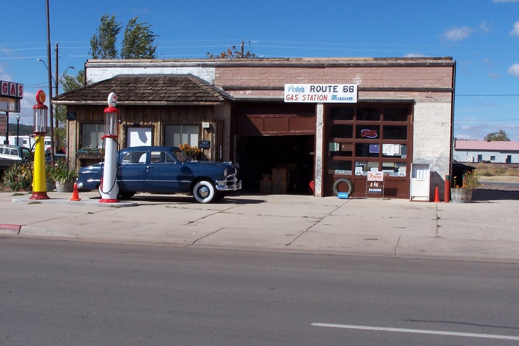 Some towns on Route 66 pay a lot of attention to its history and the tourism potential.
Here's an example with a 1930-50 gas station and late 1940's car.
Flagstaff has grown dramatically since our last visit some 20 years ago. A couple of large malls, far too many gas stations (although the competition produces prices of $2.20 per\gallon) and a lenticular spread that reminds us of Whalley, Surrey. You can hear the developers’ brains whirring – “How can we improve the wilderness?”
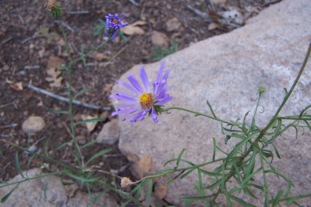 Booked into a campground at 7000’ elevation, we stretch our legs by climbing a further 600’. Along the way we find a few forms of cacti and some interesting small plants.
Seems odd to find cacti at this elevation. But then we have seen them on Savary Island and other islands around Lund BC, and while they're at sea level they are quite far north. This part of Flagstaff and Savary Island share the distinction of being just semi-arid enough to support cacti.
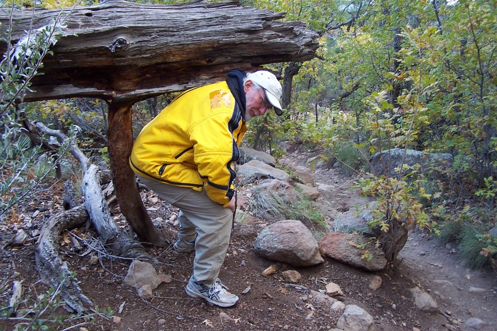 This is not a small plant, but rather a fallen tree that Roger, the crude, rough, bearded Canadian woodsman, had to lift out of the way for Marie-Claire the sophisticated, chic, urban European.
It rains during the night and the temperature drops to 2 Celsius, so it is a very cold and damp breakfast. But the hardiness (or is it foolhardiness) of British Columbians is reinforced as two fellow BCites arrive about 8 PM, pitch their tent in the rain and dark and crawl in for the night. The next morning we see that they have 3 surfboards on their car and wonder whether we should explain compass directions to them.
We had wanted to explore ruins of the Native American dwellings in Walnut Canyon but the near freezing temperatures and the rain means a rain check for another day and we push on.
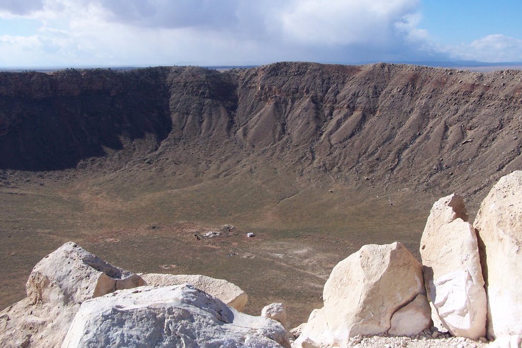 By the time we are 30 miles down the highway we are circled by clouds on each horizon but find ourselves in full sunlight and high winds. A sign for Meteor Crater prompts us to leave the highway in the hopes of getting some time in the sun before driving on into the cold front sliding down from – Canada eh? It was a worthwhile diversion.
Meteor Crater, while privately owned, is a national historic site. This 4000 foot diameter crater reaching initially some 700 feet into the ground was created about 50,000 years ago on this unbroken plain when “a huge iron-nickel meteorite, or dense cluster of meteorites, estimated to have been about 150 feet across and weighing several hundred thousand tons, struck the rocky plain with an explosive force greater than 20 million tons of TNT. Moving at hyper-velocity speed, this impact generated immensely powerful shock waves in the meteorite, the rock and the surrounding atmosphere. In the air, shock waves swept across the level plain devastating all in their path for a radius of several miles. In the ground, as the meteorite penetrated the rocky plain, pressures rose to over 20 million pounds per square inch, and both iron and rock experienced limited vaporization and extensive melting. Beyond the melted region, an enormous volume of rock underwent complete fragmentation and ejection.” Aydin, this is part of your science lesson for today. You can find more at http://www.meteorcrater.com/ Maybe these pictures will convince others to explore this crater and its history, first as an abortive mining effort to locate the minerals of the meteorite, and later the site of research to establish this as the first proven site of such a crater. Yeh, it is bit commercial, but certainly at the bearable level – and highly informative. It is also a site used to simulate the moonscape for the training of astronauts.
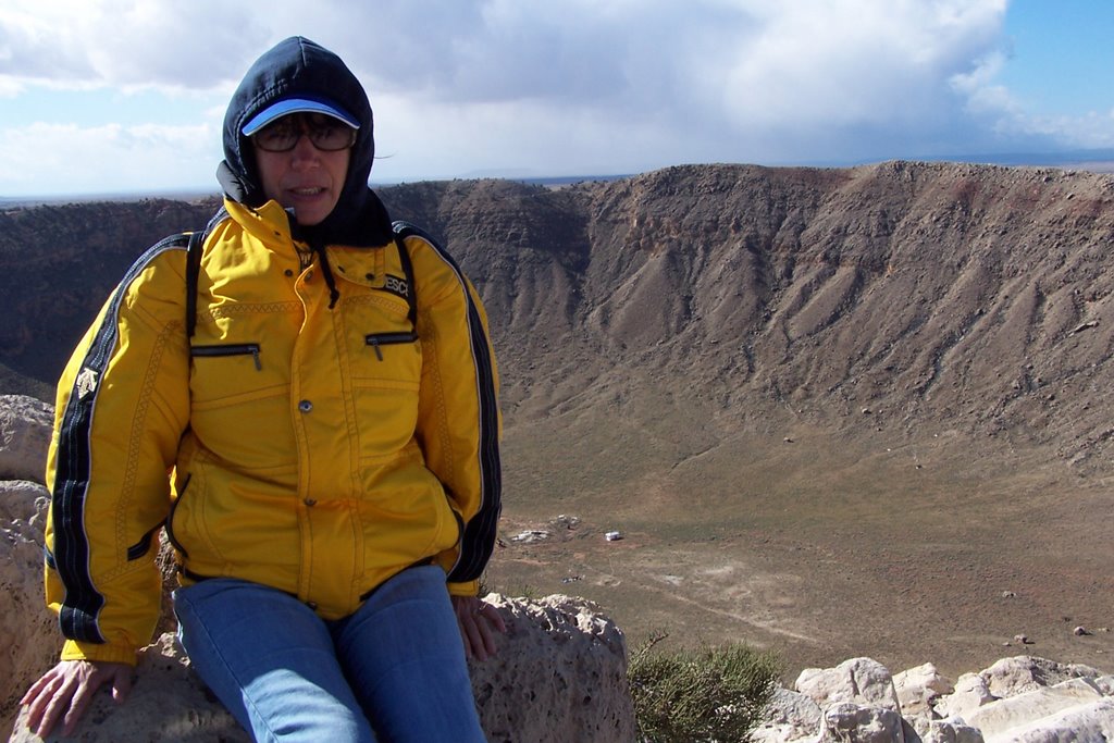 It was fun taking these pictures from the railed-in observation platforms. The wind was so high that tours of the rim had been cancelled. So these pictures were taken in winds at a steady 40 knots, (about 70 km/hr) gusting to 60 knots. We felt as though we could fly if we opened our arms and let go.
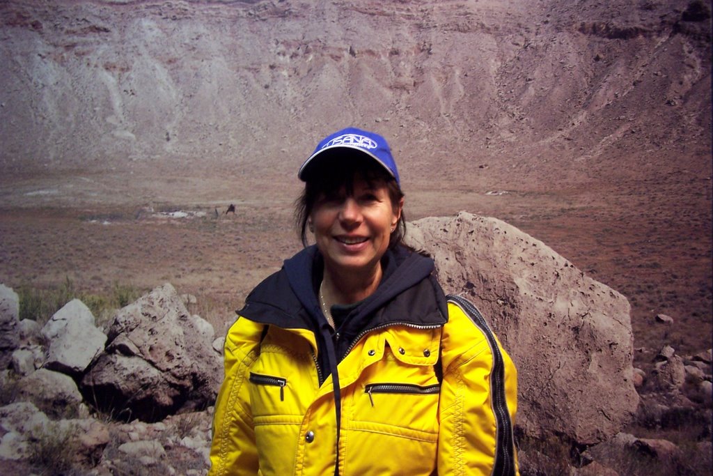
The ever-resourceful Marie-Claire managed to get her picture taken on the floor of the crater, but you'll have to ask her how she managed that.
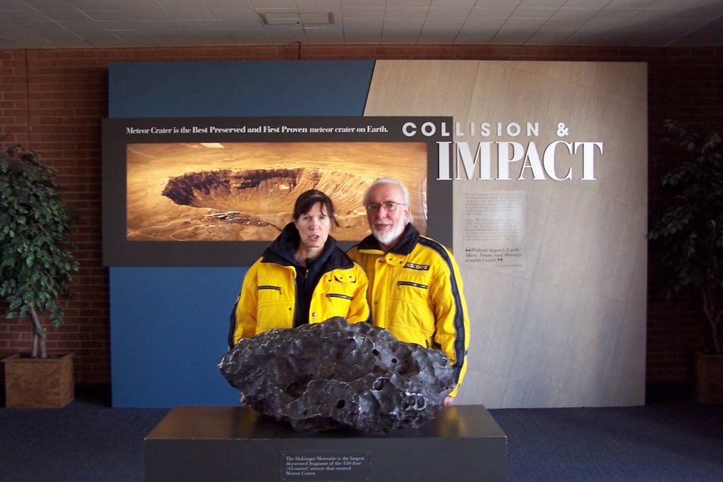
Here's a mockup, showing the estimated size of the meteorite that caused this incredible crater. It would certainly give you a bad hair day if this landed on your house.
posted by Retired and on the Move | 5:27 PM
![]()
<< Home