

Belgium - Lasne and Area
Marie-Claire’s sister Jeaninne and her husband Edouard live on a small farm (our temporary abode) in Lasne, about 30-40 minutes from Brussels. Lasne (pronounced “lawn”) takes its name from the river whose headwaters are found here. The root of the word is the Flemish “ walscher lanen” or “river of calm waters”. The center of Lasne is about 15 minutes from Waterloo, the site of the decisive battle of what in North America we call the War of 1812. The outcome of the battle had such a significant impact on the history of the western world that in a future post we’ll cover some of the headquarter sites of the various forces on each side.
But for now let’s concentrate on Lasne. Think of South Surrey and White Rock about 50-60 years ago and you’ll be able to draw a reasonable comparison. Cut down most of the trees in South Surrey and convert the land into a mix of very large, medium-sized, and small farms that have been cultivated since about 1100. Add a few hobby farms and a high ratio of horses for the upper and upper middle classes, cut the width of most of the roads in half and change some of the asphalted ones to pavé (rough-cut paving blocks about 4” X 4”X 6” deep). Lasne covers about 4,700 hectares so its 15,000 residents (about 2000 of them “foreigners” like us) are thinly spread throughout this rural community.
The farm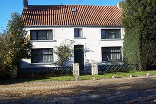
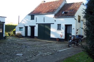
with its courtyard
is located on an ancient Roman road – Le Grand Chemin - which today consists of about 40 houses and then leads off to the northeast to Wavres and to the southwest to Nivelles, where as our lives unfold we will find our next “home”. Le Grand Chemin is at an elevation of 137 meters even though we are about 220 km from the English Channel. So while this area has lots of rolling hills and valleys between us and the Channel lies the low flatlands known as the Flanders and to the northeast Holland – Les Pays Bas – the Low Countries.

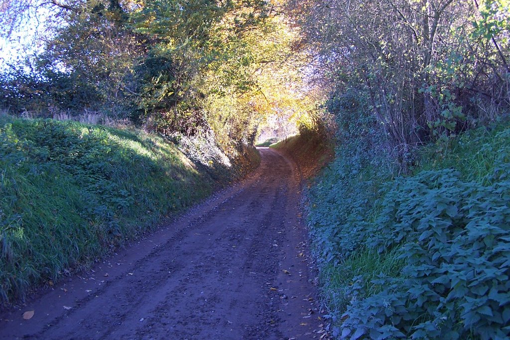
There are many pretty, but narrow lanes like Rue des Fiefs seen here.
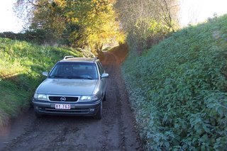
To get a better idea of how narrow, here’s an Opel in the same location.
This the lane down which we must bring our motorhome because the installation of sewers on the Grand Chemin has blocked the normal access route. Once you get off main routes in much or Europe you find roads and streets that are about wide enough for one large farm wagon pulled by a team of two horses abreast – or today one large tractor. In locations like this that means a car or truck coming in the opposite direction has to back up – or you have to back up to a place where someone can pull off enough to the side to let the other pass. We haven’t figured out the exact rules of who backs up, but the other day when we met a huge garbage truck on this road it was us who backed up. Later the same day we faced down another car, because we knew it wouldn’t have to back up as far as we would. We even gave him a nice wave of thanks, but it wasn’t reciprocated. Maybe he was having a bad hair day – or maybe we broke some unwritten but locally well known rule.
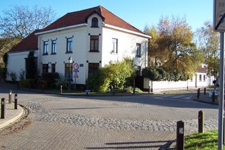
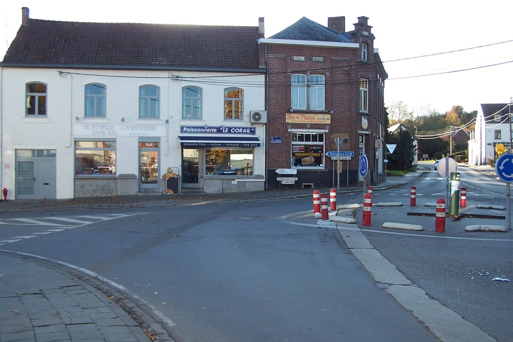
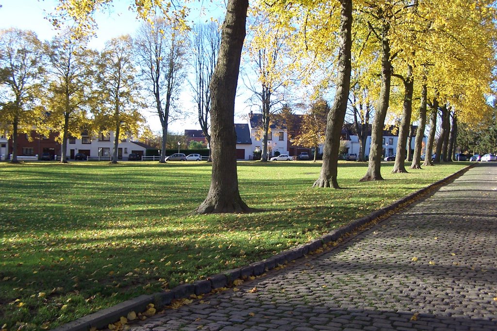
 “Downtown” Lasne has a mix of about 25 different stores each one specializing in one type of retail goods – pharmacy, shoe store, bakery and pattiserie (pastries to die for), tabac (tobacco and newspapers/magazines), chocolate store etc. and one church.

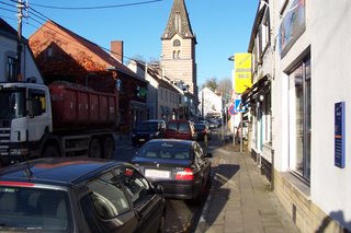
A large truck always results in a two or three minute traffic jam to allow the truck to straddle the two very narrow lanes of the road. Europe is sprinkled with towns and main streets like this. Even in larger cities there will often be neighbourhoods that look like this. Although supermarkets are fairly common all of the small retailers seem to be surviving quite happily.

A 20 minute walk in the other direction takes us from the farm to the small community of Ottignies – now part of Louvain-la-Neuve. Ottignies has a pretty town square from which hot air balloons are launched in the summer- sometimes 5 at a time.
This is an old farm house in Ottignies. To the left of the house is a large equipment garage, to the right some outbuildings and in the background the barn. Large farms in this area boast substantial buildings and seem quite prosperous (farming enjoys significant subsidies in many parts of the European Economic Community).
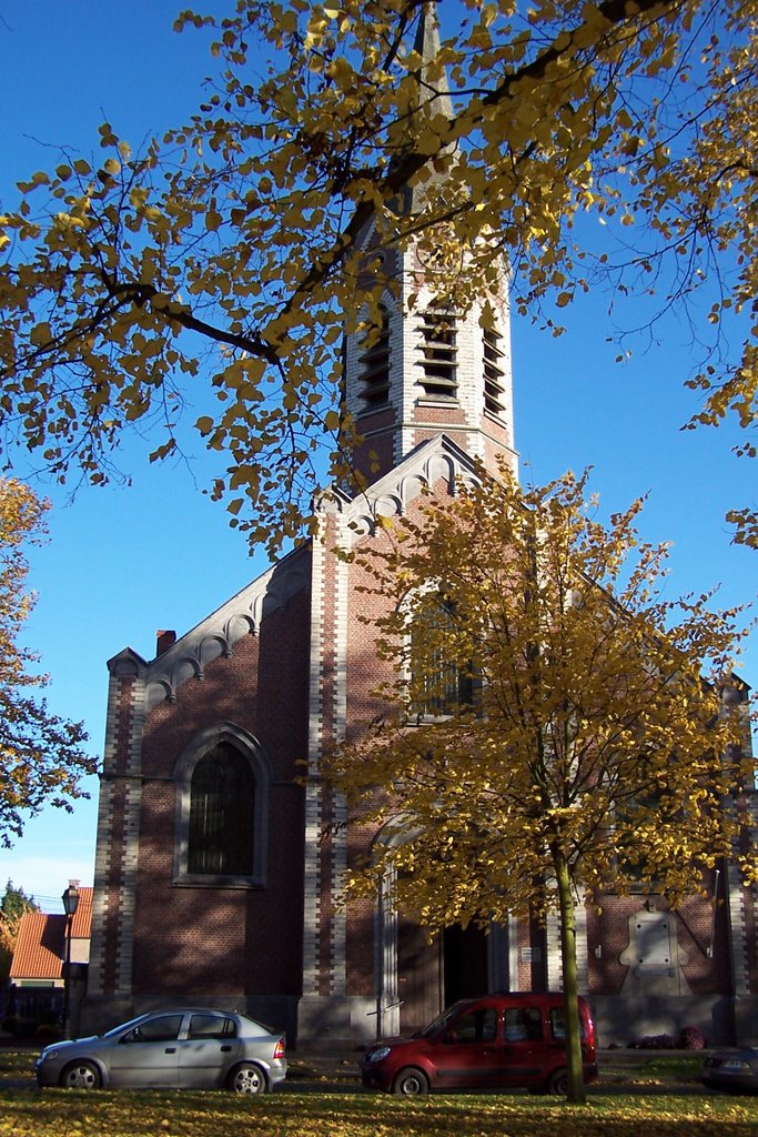
The church in Ottignies is relatively young (1780) and its side yard cemetery shows how Belgians still honour their dead with the placing of flowers on the first of November. (Marie-Claire remembers this well because her mother had a flower shop and it was very important that the temperature did not go under zero degrees C because people would then bring flowers from their garden and not buy them in the store).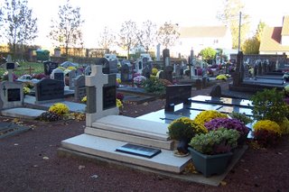
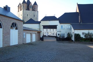
Half way between the farm and Ottignies and visible from both is the Tour de Moriensart, a fortified house and tower built by 1220 by the first seigneurs (a term that all you good students of Canadian history will remember from your studies of the French regime).
The square tower of roman civil architecture was finished in 1220 and is still inhabited by the current baron. The brick superstructure on top of the square tower was added in the 16th century. The new brick buildings (unpainted and to the left) were added recently and are used as dining rooms for events like weddings and major social events, an economic use that many historic and privately owned properties are subjected to. Inheritance taxes create challenges even for large landholders and one way to create revenue is to open these properties to paid public use.
Lasne is great for trails that are used by cyclists, walkers and horses. If you had to choose a beautiful, peaceful, historical, sportive place to live, and it had to be away from the ocean, this would be it.
But for now let’s concentrate on Lasne. Think of South Surrey and White Rock about 50-60 years ago and you’ll be able to draw a reasonable comparison. Cut down most of the trees in South Surrey and convert the land into a mix of very large, medium-sized, and small farms that have been cultivated since about 1100. Add a few hobby farms and a high ratio of horses for the upper and upper middle classes, cut the width of most of the roads in half and change some of the asphalted ones to pavé (rough-cut paving blocks about 4” X 4”X 6” deep). Lasne covers about 4,700 hectares so its 15,000 residents (about 2000 of them “foreigners” like us) are thinly spread throughout this rural community.
The farm

with its courtyard

is located on an ancient Roman road – Le Grand Chemin - which today consists of about 40 houses and then leads off to the northeast to Wavres and to the southwest to Nivelles, where as our lives unfold we will find our next “home”. Le Grand Chemin is at an elevation of 137 meters even though we are about 220 km from the English Channel. So while this area has lots of rolling hills and valleys between us and the Channel lies the low flatlands known as the Flanders and to the northeast Holland – Les Pays Bas – the Low Countries.
There are many pretty, but narrow lanes like Rue des Fiefs seen here.

To get a better idea of how narrow, here’s an Opel in the same location.
This the lane down which we must bring our motorhome because the installation of sewers on the Grand Chemin has blocked the normal access route. Once you get off main routes in much or Europe you find roads and streets that are about wide enough for one large farm wagon pulled by a team of two horses abreast – or today one large tractor. In locations like this that means a car or truck coming in the opposite direction has to back up – or you have to back up to a place where someone can pull off enough to the side to let the other pass. We haven’t figured out the exact rules of who backs up, but the other day when we met a huge garbage truck on this road it was us who backed up. Later the same day we faced down another car, because we knew it wouldn’t have to back up as far as we would. We even gave him a nice wave of thanks, but it wasn’t reciprocated. Maybe he was having a bad hair day – or maybe we broke some unwritten but locally well known rule.
 “Downtown” Lasne has a mix of about 25 different stores each one specializing in one type of retail goods – pharmacy, shoe store, bakery and pattiserie (pastries to die for), tabac (tobacco and newspapers/magazines), chocolate store etc. and one church.
A large truck always results in a two or three minute traffic jam to allow the truck to straddle the two very narrow lanes of the road. Europe is sprinkled with towns and main streets like this. Even in larger cities there will often be neighbourhoods that look like this. Although supermarkets are fairly common all of the small retailers seem to be surviving quite happily.
A 20 minute walk in the other direction takes us from the farm to the small community of Ottignies – now part of Louvain-la-Neuve. Ottignies has a pretty town square from which hot air balloons are launched in the summer- sometimes 5 at a time.

This is an old farm house in Ottignies. To the left of the house is a large equipment garage, to the right some outbuildings and in the background the barn. Large farms in this area boast substantial buildings and seem quite prosperous (farming enjoys significant subsidies in many parts of the European Economic Community).
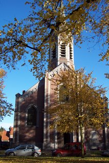
The church in Ottignies is relatively young (1780) and its side yard cemetery shows how Belgians still honour their dead with the placing of flowers on the first of November. (Marie-Claire remembers this well because her mother had a flower shop and it was very important that the temperature did not go under zero degrees C because people would then bring flowers from their garden and not buy them in the store).


Half way between the farm and Ottignies and visible from both is the Tour de Moriensart, a fortified house and tower built by 1220 by the first seigneurs (a term that all you good students of Canadian history will remember from your studies of the French regime).
The square tower of roman civil architecture was finished in 1220 and is still inhabited by the current baron. The brick superstructure on top of the square tower was added in the 16th century. The new brick buildings (unpainted and to the left) were added recently and are used as dining rooms for events like weddings and major social events, an economic use that many historic and privately owned properties are subjected to. Inheritance taxes create challenges even for large landholders and one way to create revenue is to open these properties to paid public use.
Lasne is great for trails that are used by cyclists, walkers and horses. If you had to choose a beautiful, peaceful, historical, sportive place to live, and it had to be away from the ocean, this would be it.
posted by Retired and on the Move | 9:19 AM
![]()
<< Home